What We Did
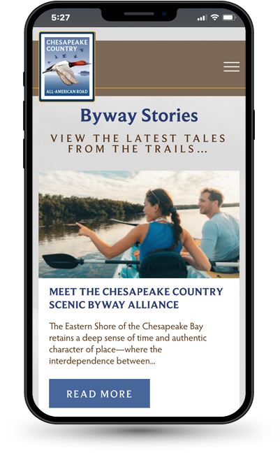
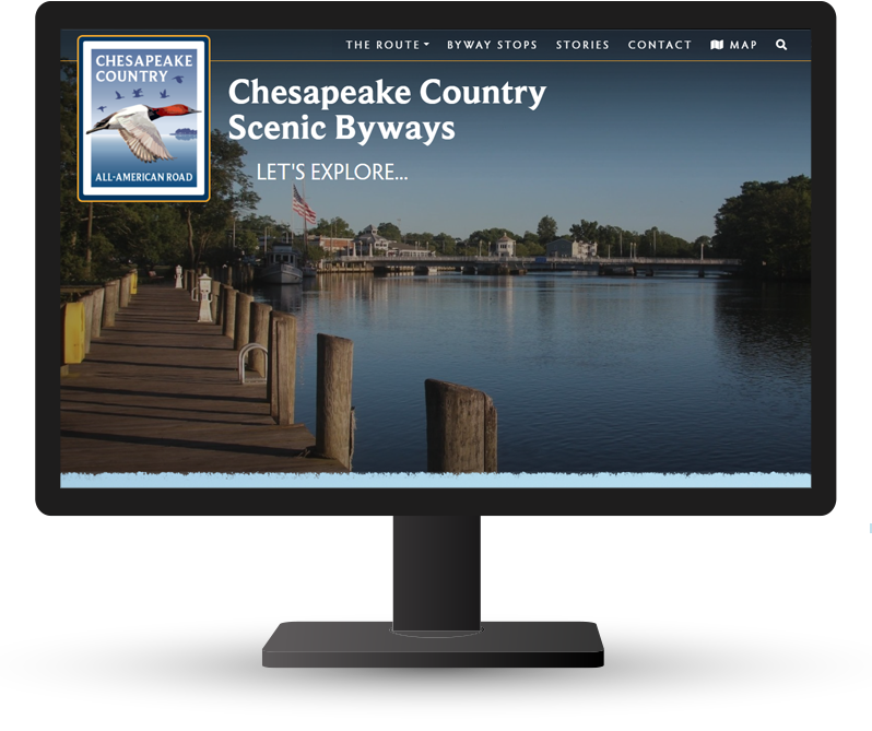
Websites
www.ccaar.org
The Story
Few places along the Mid-Atlantic are like Maryland’s Eastern Shore, where people, land, and water have long been deeply connected, and the landscapes feel wild with untouched natural beauty. The municipalities that make up the Eastern Shore have worked individually for decades to preserve our history, our beaches and forests, and to share our traditions with visitors.
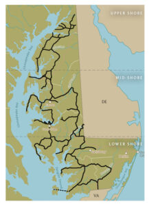
But, as technology advances, nine local counties chose to work together to create a federally designated National Scenic Byway, showcased on an interactive web-based map with routes that travelers can follow in real-time. The Chesapeake Country All-American Road is a network of scenic and historic travel paths that stretches 419 land miles across Maryland’s Upper, Middle, and Lower Eastern Shore.
Many know, as you journey across our tidewater landscape, discovery doesn’t follow a fixed route, and sightseers often care more about finding the waterman’s catch of the day than the borders between counties. The Byway website stands out as an engine fueling the tourists of tomorrow, with dynamic Google Maps that link each attraction and route to the individual traveler, creating a truly personalized experience.
The Byways committee representatives found unity in a shared purpose, and our D3 team helped to find a tactical, user-first way of showing visitors historical, cultural, and natural places to go, and how to get there.
Our Journey
In tomorrow’s tourism economy, real-time data and AI will drive where people choose to go and what they experience. At D3, our mission is to ensure the Delmarva region is always one step ahead—responsive, relevant, and ready to inspire.
A directory listing of businesses dispersed across a large region is no longer going to cut it. Which is why we decided to bring the list to life, with real-time information based on the user’s location and interests. Tourism of the future is hyper-personalized, and the responsive maps embedded within the Byways project are the key—adapting instantly to changing plans, local insights, and traveler preferences.
Our development team engineered a robust tourism platform that transformed how travelers explore Maryland’s scenic byways. Using Google Maps integration and a fully custom mapping system, we created an intuitive experience where users can visualize routes, discover attractions, and plan their adventures in real time.
With interactive map dots highlighting the best stops and seamless mobile functionality, our D3 team turned a static travel guide into an engaging, on-the-go exploration tool, whether someone is driving along Route 50, craving the perfect soft crab sandwich, or planning a full day family adventure on the go to St. Michaels in Talbot County.
And the best part? For our D3 team, this is just Phase 1. We’ve laid the foundation for the next generation of tourism tools, bringing Delmarva to life digitally. With this in place, we’re poised to harness AI and other emerging technologies to redefine the travel experience, guiding visitors not just to destinations, but to the heart and soul of regions.
Testimonial
“We recently partnered with the D3 team to create a brand-new website highlighting the Chesapeake Country Byway. Their team made the entire process incredibly smooth, with excellent communication and attention to detail at every stage. We’re thrilled with the final result and couldn’t be more proud! Thank you, D3, for bringing our vision to life with such stunning design and user-friendly functionality.“
—Worcester County Tourism
“The Chesapeake Country All-American Road Alliance (CCAAR) selected D3 to design and launch a custom website for the 419-mile All-American Road. From the beginnin,g it was clear this project was more than “just another website build” for the D3 team. D3’s team worked collaboratively with the 12-member alliance, welcoming new ideas, brainstorming creative solutions, and applying the latest digital tools to achieve the best possible results. They were responsive, flexible, and patient, ensuring no request went unanswered. Their work ethic, professionalism, and personal investment in the project resulted in a website that not only meets the needs of today’s traveler but also elevates Maryland’s profile on a national and international scale. D3 exemplifies the very best of Maryland small businesses: they deliver cutting-edge technology, support tourism development, and strengthen the communities where they live and work.”
—Kristen Goller